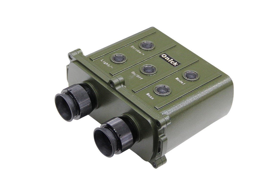
Beneath the power poles being inspected, the midday sun was blinding. The veteran technician wiped the sweat from his brow, recalling how measuring pole spacing used to require his apprentice to run back and forth with a long ruler, each person holding one end to align with the mark, and repeatedly checking the measurement—a slight miscalculation could lead to an error. Now, he held up the Onick CI series binocular rangefinder with one hand, brought it close to his eye, and gently pressed a button. A clear value instantly appeared on the screen; no shouting, no waiting—he completed what used to take half an hour in seconds, and a relaxed smile appeared on his face.
In the mountains of geological exploration, the team climbed up a gravel path, their trousers covered in mud. The first half was smooth, but at a steep slope, they stopped—the terrain ahead was undulating, and to plan a safe route, they first had to determine the elevation differences. In the past, they would have had to squat on the ground, spread out maps, and slowly calculate using coordinates, always worried that mistakes would affect the rest of the journey. Someone pulled an Onick CI rangefinder from their backpack, aimed it at the top and bottom of the slope, and with a few simple adjustments, accurate reference data was generated. The team quickly determined their direction and continued on their way.
In the dense forest used for forestry surveying, layers of branches and leaves fragmented the sunlight. A surveyor needed to measure the height of a century-old tree. After circling the tree twice, the branches and leaves completely blocked the view, making it impossible to pinpoint the top of the trunk. Previously, they would have had to find higher ground or use a long pole to probe, which was both time-consuming and inaccurate. He then took out his Onick CI series binocular laser rangefinder, the team's newly upgraded equipment. With a slight adjustment to the general direction, the device intelligently filtered out the interference from the branches and leaves, directly locking onto the key positions at the top and bottom of the trunk. The data came out quickly and accurately, saving considerable effort.
In outdoor surveying, accuracy is always paramount. When measuring cable spacing across a river, strong winds can easily obstruct visibility. Previously, traditional tools were prone to inaccuracies, requiring repeated measurements and manual calibration. This binocular rangefinder, however, never disappoints. Even at a distance of hundreds of meters, it automatically performs multiple measurements and calibrations, providing reliable results, eliminating anxieties about errors. Moreover, it's incredibly easy to operate, with no complicated buttons or parameters. Newcomers can learn to use it independently after a short training session with experienced technicians, saving considerable time and effort.

For long-term outdoor work, the practicality of tools significantly impacts efficiency. Geological exploration team members spend a day in the field measuring numerous points. Previously, they had to painstakingly write down data in notebooks, then spend late into the night checking and organizing the densely written notes, easily making mistakes. Now, with this rangefinder, measurement data is automatically stored. Back at camp, simply connect to the internet to directly transfer the data to a computer, eliminating the hassle of handwriting and verification, allowing everyone to rest earlier.
When repairing telecommunications cables at night, it's common to struggle to see data in dim lighting. However, this device features a built-in screen light; a simple press illuminates the screen with a soft glow, making the values clearly visible. This eliminates the need for a flashlight and ensures the repair progress isn't delayed. For tasks requiring orientation planning and vertical distance calculations, additional functions can be added as needed. Whether measuring rooftop heights during construction or selecting campsites in the wild, it handles these tasks with ease, far more convenient than carrying a separate compass or angle measuring instrument.
What's impressive is that despite its many practical functions, it's incredibly portable. Its moderate weight prevents shoulder strain, allowing it to be easily stored in a work bag for river and waterway surveying or in the main compartment of a backpack for hiking and camping. No need to allocate a large amount of space; it's effortlessly portable. From power line inspection and geological exploration to construction, forestry surveying, and even hunting, camping, and mountaineering, the Onica CI series binocular laser rangefinder is like a reliable and silent helper, making measurement tasks simpler and more efficient and worry-free for every outdoor operation.


